
Queen of Track Building
Posts: 1613
Joined: Sun Dec 08, 2013 11:47 am
Location: Atlanta, GA, USA
Cars: Chevy Cobalt
![]() Mon Jul 28, 2014 1:29 pm
Mon Jul 28, 2014 1:29 pm
Re: Request a (real world) track here
07CobaltGirl wrote:taoistlumberjak wrote:07CobaltGirl wrote:
I'd be willing to tackle this, but I have other things to finish first. That would be a BIG project. I DO love Le Mans, however!If you PM me some elevation data to use (or links) and maps, it would make it easier (unless you don't have all of that yet).
Haha, there's the problem I ran into. There's decent info on the modern versions (which I hadn't yet found), but the pre-1932 configurations are a blank. I'm not too sure on which roads were part of the circuit. Heck, even after 1955 there was a shift involving the front straight, where they moved the pits around for safety reasons.
Maison Blanche: For news and history of the Le Mans 24 Hours
I assume you found this? Only a layout and length, but it is a place to start. I'm sure, in the past 90 years, the roads around the track have changed significantly (which seems to have prompted many of the layout changes in the first place), but certainly an overlay could be made from each of these and get a general idea. I will work on some of them, but it will take a while to get them right.
EDIT: Here's another similar site, but easier to view IMHO.
The Le Mans Project by Virtua_LM
First of all, my apologies for this image. It is rather large, so if you are on dialup or have bandwidth restrictions, stop now. I stitched this image from google earth to maintain some of the resolution. I then used the 1923 image as an overlay to get a track line. Here we have the 1923-1929 Le Mans Circuit:
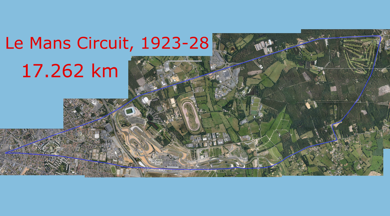
I did not have time to make a track yet. The image will have to be sized down for use, and it will take a while as it is 17km! I can eventually do the rest of them, using basically the same map with different overlays. This project is certainly possible, but will take some time, which I do not have just at this moment. The only thing left for this map is to gather some elevations from google earth (or any other more reliable source), reduce the image, and make a track file!
EDIT: Image reduced to 1280x720 and the line cleaned up to match the track map more, but it will need to be rotated for a proper start. A few of the roads do not seem to connect any longer, and there is also the pesky round-about which probably didn't exist in the 1920's. Actually, with the site listed above, and this stitched map, this might not be as hard as I thought.
Only TWELVE more to go! hahaha (current track is already done by someone else). If you want, I can send you a PS file of this and you can give some of them a go?

Swanson Motorsports Engineering Atlanta, GA, USA
American performance has no compromise!
Company ID: 1969666
SME on Automation Hub!
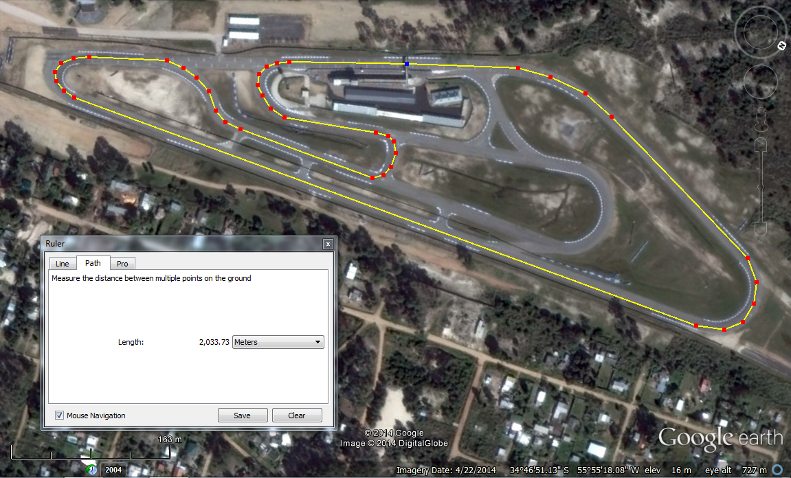
List of 2014 F1 tracks available **19/19 complete** Not all credit goes to me
Request your favorite track here